|
1. The map which destroys China's
claim
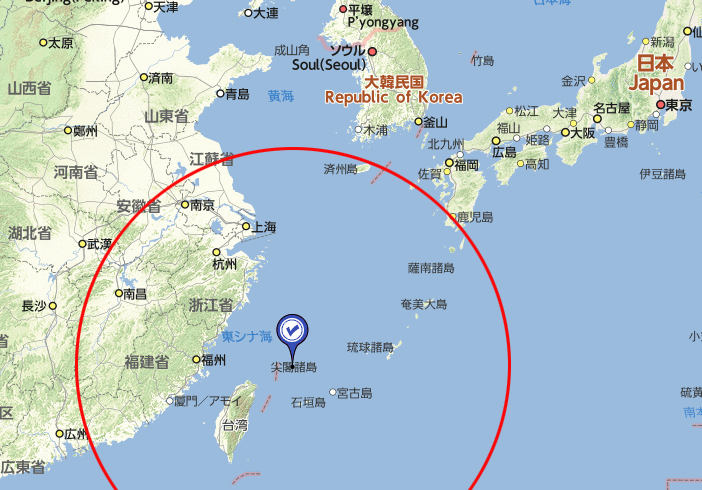
Though Senkaku Islands are Japan's
territories, China claims they have been her territories since
ancient times(Please refer here).
China repeats political and military
actions for her claims. This is Senkaku Islands issue.
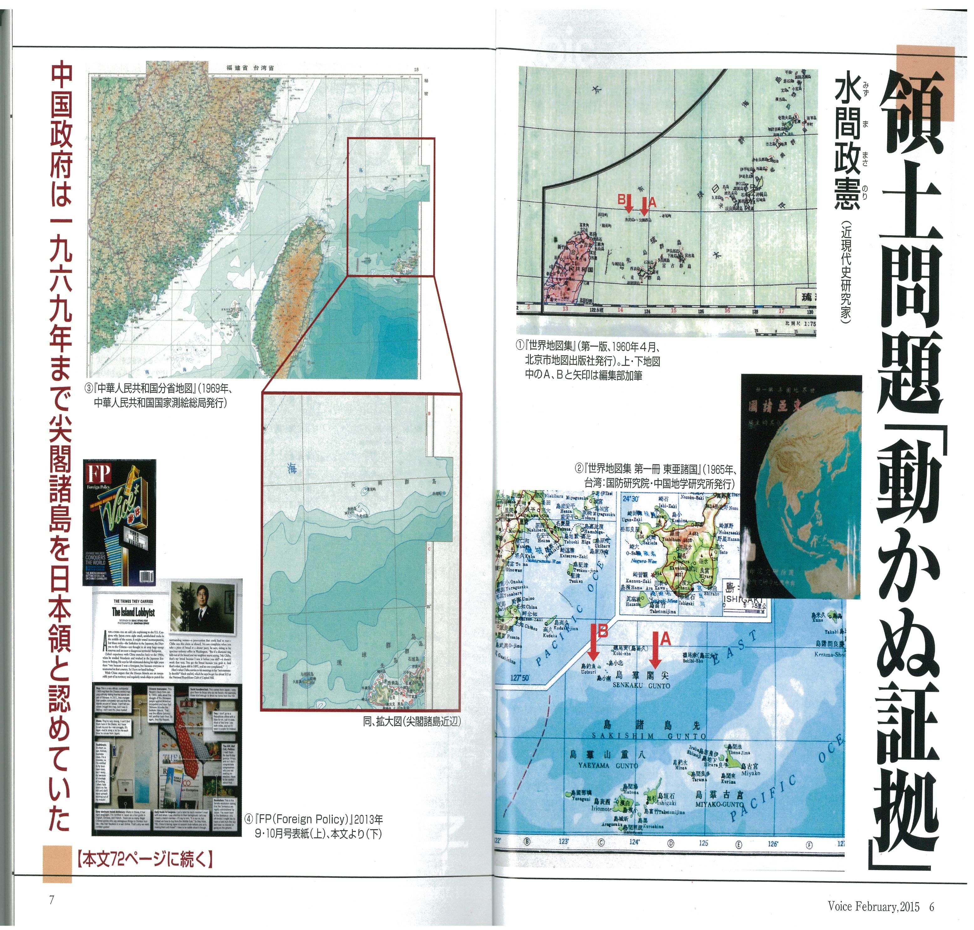
But the conclusive documents
were
found. The maps made by China destroyed her claims. They proved China also understood
Senkaku Islands were Japan's territories.
I quoted the following sentences from the blog by
Mizuma Masanori, a Japanese journalist.
I found Chinese
government officials with millions of yen in their pockets went
round shopping in Japan for the maps of Senkaku Islands issued by
China when I got a scoop on a map with "Senkaku", Japanese naming
which was published in Beijing in 1960. This article was run in
"SAPIO" in November, 2004.
Now the Foreign Ministry have posted this
map issued in 1960 as the most
incontestable evidence which shows clearly Senkaku Islands are territories
of
Japan.
|
|
1.中国の主張を覆す地図
尖閣諸島は日本領にもかかわらず、中国は古来よりの自国領だと主張しています(
参考URL)。
中国はその主張のため、政治的、また軍事的な行動を繰り返しています。
これが尖閣問題です。
しかし決定的な資料が見つかりました。中国製の地図が、その主張を覆したのです。中国もかつては尖閣諸島が日本領であると考えていたことが証明されました。
以下ジャーナリスト水間正憲氏のblogより引用します。
中国政府関係者が、中国で発行した尖閣関連地図を、ポケットに数百万円ねじ込んて
買い漁っていたことがわかったのは、2004年11月に『SAPIO』誌に、
1960年に北京で発行した尖閣と日本名表記の地図をスクープしたときでした。
実際、現在、外務省も尖閣諸島が日本領を中国に主張できる最強の資料として、
1960年の同地図をホームページにアップしてあるのです・・中略・・
|
|